Smart Construction Drone
Quick, accurate mapping of your job sites
Gathering topography is safe, quick & easy. It is 50% faster than a walking survey. Using this will help with the job as the data you get can turn into efficiencies and better reporting.

Features and Benefits
Easier and Faster Surveys: Receive information in as little as 30 minutes. This also prevents those doing a manual survey from navigating potential hazards on the ground.
Unlimited Tracking: Flying as much as you want & need helps to gather & analyze data throughout your project. Measure daily, weekly or whenever needed.
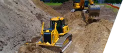
Limit Downtime: Continue working as the drone flies high above your activies.
Enhance Your Team's Capabilities: Using frequent aerial mappings by drones will give you hundreds of thousands of points instead of hundreds of points giving you more clarity.
Operational Cost Savings: Speed up your topograhic surveys and save money by using drones rather than a traditional one.
View Your Jobsite Progress from the Sky: Take still photos and videos for pre-job verification or keeping others up to date on progress. Drones can take photos and videos from under bridge decks or up to 400 feet above ground level.
We are here to assist you with any training and support you might need for projects. Whether it’s operator training to get the most out of your intelligent machines, or supporting you on your digital transformation, we care about your success. Our Smart Construction specialist are on the phone, online or at your job site to make sure you get the most out of your investments.
Learn more about all the Smart Construction solutions available.